Railroads & Locomotives Maps Chesapeake & Ohio in the West Virginia coal fields

Chesapeake & Ohio in the West Virginia coal fields

By Angela Cotey | April 21, 2010

| Last updated on March 17, 2021

Lines and the mines that made Chesapeake & Ohio a powerful force in coal transportation.

Email Newsletter

Get the newest photos, videos, stories, and more from Trains.com brands. Sign-up for email today!

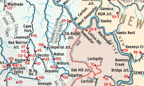
Eastern coal railroads issued maps of coal mines they served for the information of customers. This map (redrawn for clarity) shows C&O’s New River and Kanawha (Ka-NAW) Districts in 1966. their common border marks the divide between high and low volatile coal measures, an important distinction that determines whether coal is used to make coke for steel mills, or to generate electricity.

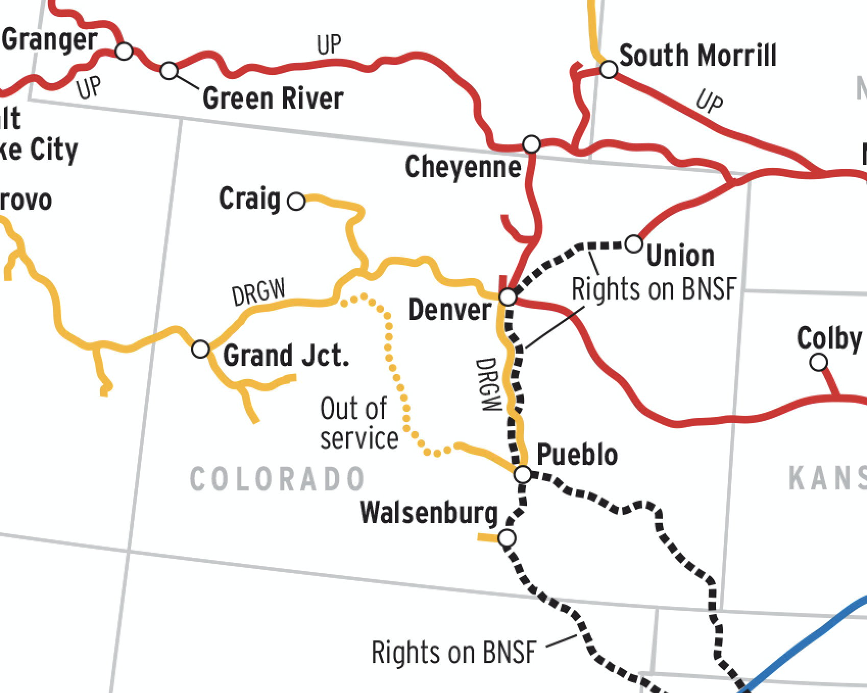
Railroads included in this map:
Chesapeake & Ohio

Download the map
Success, start your free download!
Download the map PDF
You must login to submit a comment