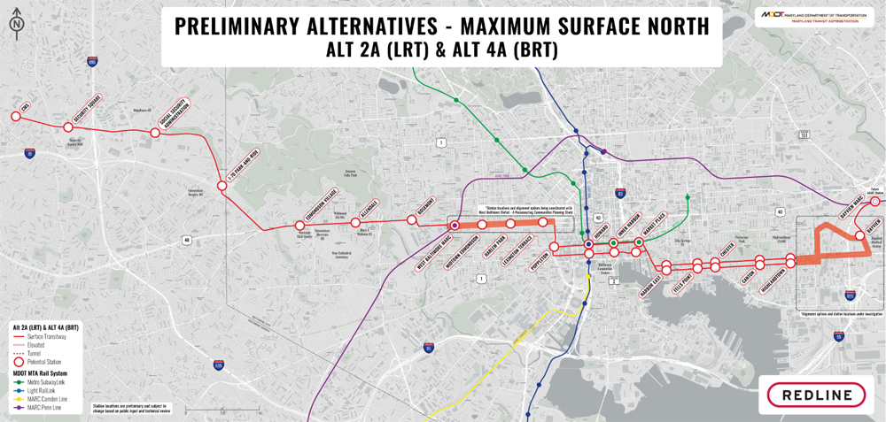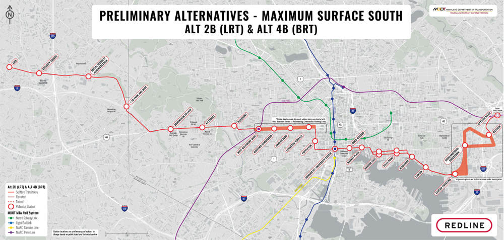
BALTIMORE — The Maryland Transit Administration has released maps showing three potential routes for its east-west Red Line transit project, an approximately 15-mile route between the western community of Woodlawn and the Johns Hopkins Bayview Medical Center via downtown.
All three routes include both light rail and bus rapid transit options; the ultimate form of transit has yet to be determined.
The options released reduce from seven the number of alternatives presented last year [see “Baltimore area takes next step …,” Trains News Wire, Nov. 16, 2022] and were developed based on responses received during a comment period last July. Another round of open-house meetings is set for November to discuss the preliminary alternatives, including projected costs and ridership, and a timetable to develop the system.
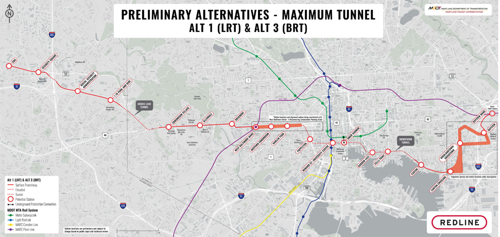
The options released Thursday include a “Maximum Tunnel” alternative, shown above, that would include construction of a tunnel beneath downtown, as well as some elevated sections. The Baltimore Banner describes this version as closely resembling the Red Line proposal killed by former Gov. Larry Hogan in 2015. The other two versions, below, are north- and south-oriented surface and elevated routes; the Maximum Tunnel and Surface North routes would include interchanges with MARC commuter rail, the 30-mile Light RailLink system, and the Baltimore subway, while the Surface South version would forego a subway interchange. Links to full-size versions of the maps and additional information are available here.
“The Red Line is a major priority for our team and a critical project for the Baltimore region,” Maryland Transit Administrator Holly Arnold said in a press release. “The maps of the preliminary alternatives and other information will help stakeholders come to our November open houses fully prepared with questions and comments to keep the Red Line project moving forward.”
Those meetings will be held Nov. 2, 6-9 p.m., at Woodlawn High School in Gwynn Oak, Md.; Nov. 4, 10 a.m. to 1 p.m., at the University of Maryland-Baltimore SMC Campus Center; Nov. 8, 6-9 p.m., at the Greektown Square and Event Center in Baltimore; and Nov. 9, 6-9 p.m., at Edmonson Westside High School in Baltimore.