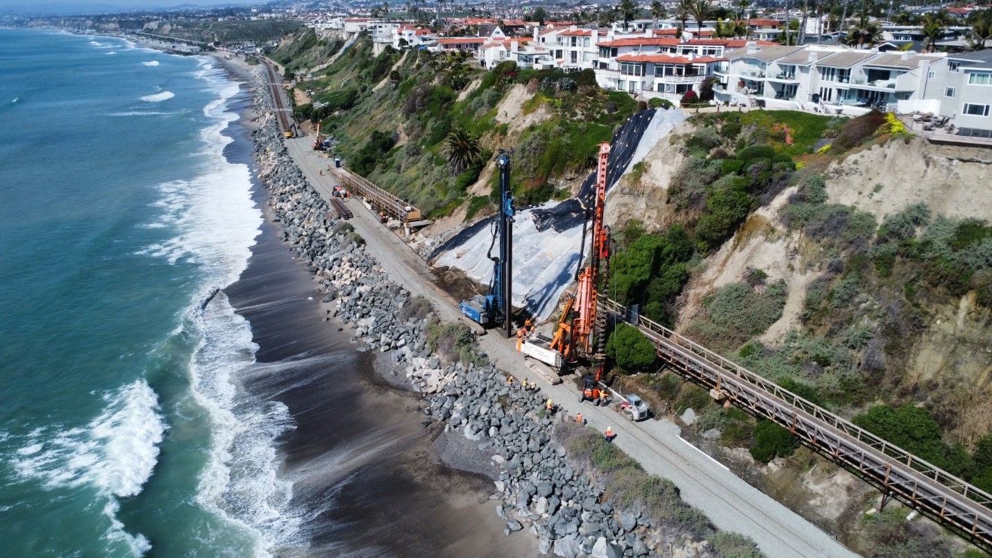
SAN CLEMENTE, Calif. — Work has begun on a 200-foot-long wall to protect the Surf Line rail right-of-way from landslides at the site that has halted passenger train traffic through San Clemente since Jan. 24, the Orange County Transportation Authority announced.
The wall, expected to be 10 to 15 feet tall, will be anchored by support beams placed 30 feet below ground. Drilling rigs began preparing holes for those support beams on Tuesday, Feb. 27. The wall will be similar to one built last year below the nearby Casa Romantica Cultural Center and Gardens, site of the last slide that interrupted operations by Metrolink and Amtrak’s Pacific Surfliner. BNSF freight traffic past the slide site is also currently halted because of continued hillside movement; freight trains have been able to move intermittently during overnight hours, based on hourly monitoring of the hillside and stabilization work.
Current estimates are that the wall will be completed in mid-March, and that regular passenger service could begin late that month or early in April, once track repairs are complete.
Metrolink spokesman Scott Johnson told KABC-TV that the work is “very, very challenging.
“The area is so incredibly narrow in terms of the workspace and the equipment that needs to be brought in. … That right-of-way is relatively narrow, only about 100 feet wide. The hillside is all privately owned so we are unable to really do anything to stabilize the hillside, not only at Mariposa Beach but along the entire San Clemente bluff.”
Metrolink service remains suspended south of the Laguna Niguel/Mission Viejo station on weekdays; weekend trains run as far as San Juan Capistrano. Pacific Surfliners continue to operate on a modified schedule including cancellations and a bus bridge; the latest version of that schedule is available here.


Looking at the picture atop the article here, it appears that 200 ft of wall will do very little to fix the problem. It appears that most of these houses are very close to the edge of the bluffs. California has had many coastal landslides over the years. It would seem to me that any set backs were totally ignored. What is going to happen when one or more of these homes slide of these bluffs? It is not if it happens it is when.
The tracks need to be relocated to the center of the I5 freeway. Otherwise stabilizing the cliffs will need to happen the entire length of San Clemente, along with sea level rise necessitating raising the tracks, will cost more than relocating the tracks.
How wide is the I-5 freeway median? Does the median happen to have a spare, unused, 75-foot wide swath for train track(s) or perhaps wider for a station? Have you figured in the cost of rebuilding draining, lighting, the centrals piers of overpasses, sign bridges, etc? How about the roadway skews and bridges at the points where the tracks enter or leave the median.
Adding to Charles’ points, what are the grades on I-5? Are they low enough to run both passenger and freight service along a line in the median? Most railroads want 1.5% or less these days, and 2.2% was historically the maximum for “good” construction. A quick check on Google Earth suggests the current grades are closer to 4-5% in multiple places.
Something needs to be done about the line, but I don’t think I-5 is the answer.
Was the hillside privately owned when the rail line went in? I can’t imagine why the railroad would have wanted to build so close to the shore.
If the property is privately owned, why can’t you work with them to stabilize their land or hold them responsible for stabilizing it. If there was building done, who permitted it? Sounds like more reckless government incompetence leading to more costly government spending.