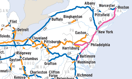
This Map of the Month appeared in the January 2006 issue of Trains magazine.
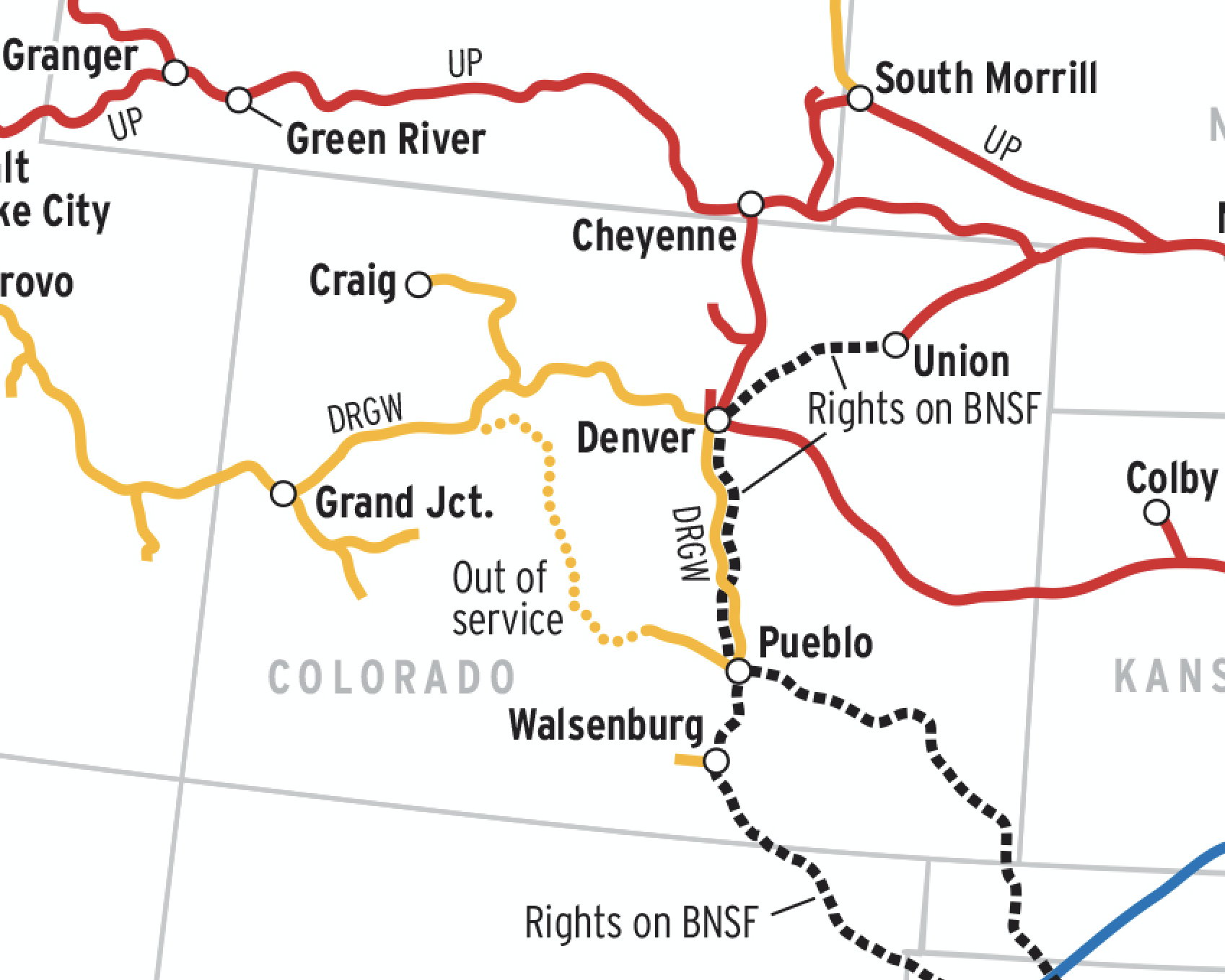
Pick up any state highway map and the multi-lane roads are shown prominently. Most railroad maps don’t distinguish between single and double track, however, so to compile this map of U.S. multiple-track main lines, a variety of other sources had to be consulted, from railroad engineering and division maps to employee timetables.
Given the map’s national scope, we purposely did not highlight segments of multiple track less than 20 miles in length (which would appear on the page as little more than a speck), or routes where sections of single and double track alternate closely. Conversely, some multiple-track lines have brief sections of single track (i.e., BNSF in New Mexico’s Abo Canyon, or CSX’s ex-B&O on the west slope of Sand Patch grade); for clarity, those routes are shown as continuous multiple track.
All of the lines represented here are what can be considered the main lines of the United States — those routes carrying more than 10 million gross tons a year, plus Amtrak’s Northeast Corridor; they encompass 52,223 route miles, or about 37 percent of the entire 141,000-mile U.S. rail network. Data filed with the Surface Transportation Board indicates that Class I railroads own 16,000 miles of road with two or more main tracks.
Over the past 50 years, double-track mileage in the U.S. has shrunk, while the number of ton-miles has more than doubled. In the early 20th century, the location of multiple-track rail lines matched market demands, proliferating between the East Coast and Chicago, on Appalachian coal roads, passenger-heavy routes to the South, and the transcontinental lines of the Santa Fe and Union Pacific. Traffic declines after Word War II prompted railroads in the overbuilt East to rid themselves of multiple track, while a shift in traffic generation pushed more freight onto single-track lines in the West, creating a wider discrepancy between U.S. traffic flows and the capacity of its physical plant.
In more recent times, Union Pacific and BNSF have financed giant track expansion projects on routes leading from Wyoming’s Powder River Basin and main lines between Chicago and L.A., while relying on parallel routes gained from earlier mergers to thread traffic through other busy, single-track regions, such as Texas.
Railroads included in this map:
Amtrak; BNSF Railway; Canadian National; Canadian Pacific; CSX Transportation; Norfolk Southern; Union Pacific